Sometimes a good reason is not sufficient for changing our minds. This can be said also in Science. Thomas Khun studied how strong changes in perspectives, theories and methodologies in Science have been made along history. He studied the dynamics of those paradigm changes and argued that scientists have to be convinced first before accepting new paradigms. Then little by little, it begins to teach in the universities and, finally, it reaches secondary education. When the necessary paradigmatic tools are already taught in school, there is no doubt that the paradigm has triumphed.
Mars exploration is a promise for humanity, it is a huge enterprise made of a wide international network that involves many cultures and cosmovisions. The Outer Space Treaty signed in 1967, declares those territories as the heritage of all humanity in a similar way to Antarctica, so that “their exploration and use must be done for the benefit and in the interest of all countries.”

What could be named the “Mars paradigm”, has been generating a huge amount of stories and knowledge that allow us to rethink ourselves as humans in connection to the cosmos. But still is not entirely embedded in schools.
However, there will be a moment in the future when the “Mars paradigm” will be established and then schoollarized. A moment when we study the revolutionary perspectives achieved in our past Martian exploration in a more augmented conscience.
Imagine when this happens in the future. Maybe children at that time will use school maps of Mars for their homeworks or classrooms.
The same way we do with geography on Earth, they would start to approach the study of the lands, features, inhabitants, its human and natural complexities in a geography Mars subject-matter. Actually, the geography of Mars is called Areography. As a subfield of planetary science, it deals with the delineation and characterization of regions on Mars. While Areography is mainly focused on physical geography and their cartographic representations, we want to expand such a cartography involving Art and the cosmos. To develop school geographies of Mars or better… to develop a “Marsgraphy” = Art + Areogrpahy.
You, like many people, may remember the maps of our childhood. Those ones for the notebooks, the murals and mute maps for the classroom. Their shapes, colors, papers, textures and smells are impregnated in your early memories.
Certain maps are part of the rememberings trespassing many generations of students until now. For example, traditional A5 size school maps for children in Argentina looks like this:

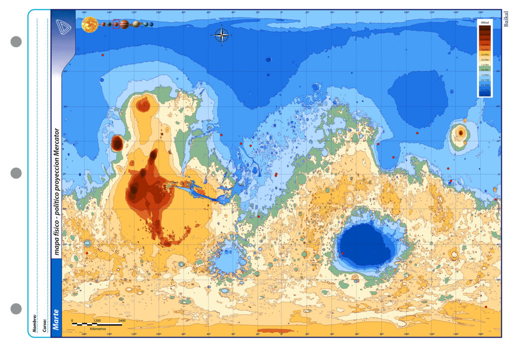
Or one of the well known school maps in Spain:

Let’s then create maps of Mars, artworks with that school resemblance from the present and past for children in the future.
How to do it?
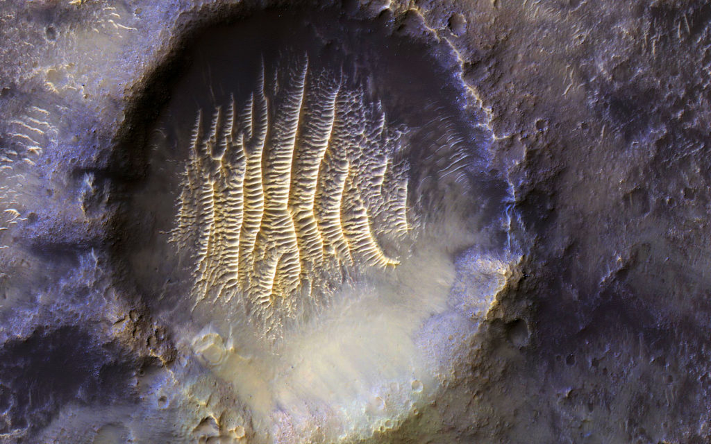
Mars has been mapped very precisely during the last few years due several space missions. Mars Orbiter Laser Altimeter (MOLA) collected around 700,000,00 laser pulses scanning Mars. Data is available and can be taken to be adapted for designing the maps to resemble those iconic school maps.
MOLA images are extremely precise, scanning the altitudes of the planet and generating a very detailed color visualization of Mars.

For school maps, a different scale of colors has to be defined, taking intervals of altitudes for different color scales as usual in physical maps scales. So we’ll need a “Zero Level “ on Mars.
There are no oceans on Mars, so “zero level” altitude is arbitrary. On Earth, the zero elevation (called “datum”) is based on sea level (the geoid). The datum for Mars was defined initially in terms of a constant atmospheric pressure. From the Mariner 9 mission up until 2001, this was chosen where the pressure is of 610.5 Pa (6.105 mbar) on Mars. On the basis that at this pressure you have the triple point of water, it means you’ll find the water in the solid, liquid and gaseous state coexisting in equilibrium. So the zero level on Mars would be all the surface on the planet at that pressure.
In 2001, Mars Orbiter Laser Altimeter (again MOLA) data led to a new convention of zero elevation defined as all the surface with the same gravitational attraction whose average value at the equator is equal to the mean radius of the planet.
Right, but our school maps will also need a Zero Meridian!
The location of the first Zero Meridian on Mars was specified arbitrarily as is Earth’s (Greenwich meridian). The German astronomers Wilhelm Beer and Johann Heinrich Mädler selected a small circular feature in the Sinus Meridiani region, as a reference point when they produced the first systematic chart of Mars features in 1830–1832.
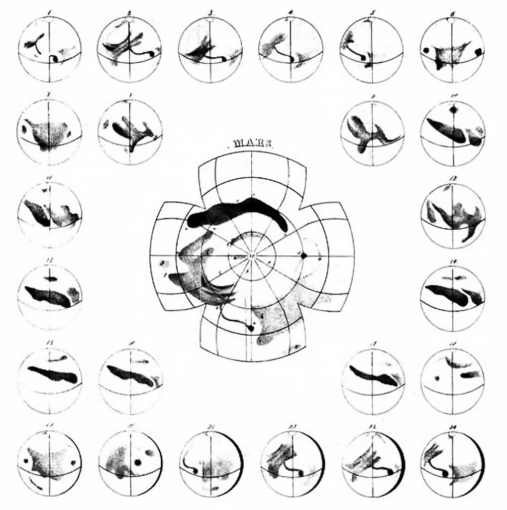
Their choice was adopted as the prime meridian by the Italian astronomer Giovanni Schiaparelli when he began work on his notable maps of Mars. Later, zero meridian was abandoned at the beginning of XX century, the names of ephemerides would guide to observations.
When the Mariner 9 spacecraft provided extensive imagery of Mars in 1972, the Geodesy / Cartography Group proposed that the prime meridian pass through the center of a small 500 m diameter crater named Airy-0, located in Sinus Meridiani along the meridian line of Beer and Mädler, thus defining 0.0° longitude with a precision of 0.001°. This is our zero meridian on Mars at the present.
Continuing with our map; we’ll also need an Equator on Mars!. Fortunately this is very easy: Mars’s equator is defined by its rotation. !!
Each color then will correspond to a range of altitude. For example, a light blue color for 0 to 1000 meters, a lighter blue color for 1000 to 2000 meters, and a darker one for 0 to -1000 and so on…
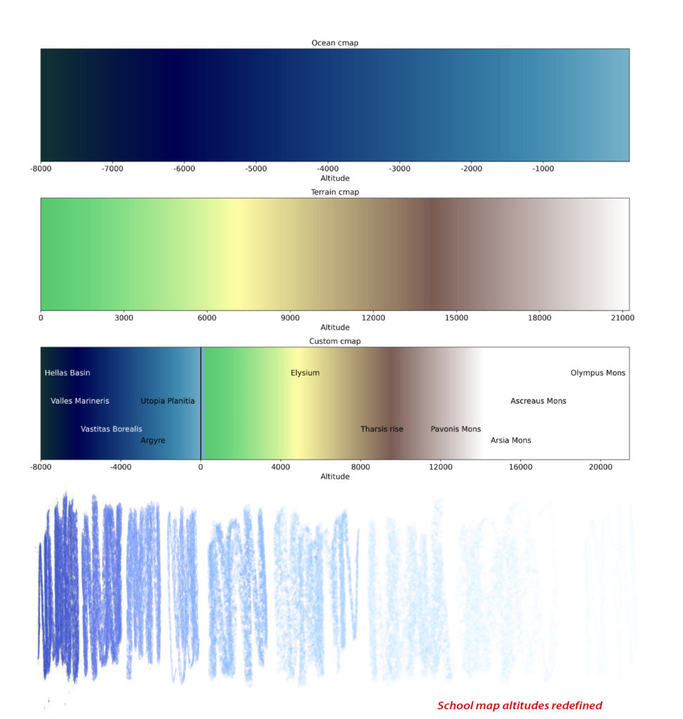
Chunks of maps are then drawn with a particular color for each interval of altitudes.


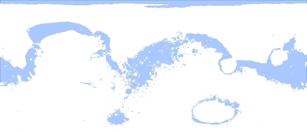
Completing the puzzle, we have an A5 size school map of Mars resembling traditional small Argentinian school maps.
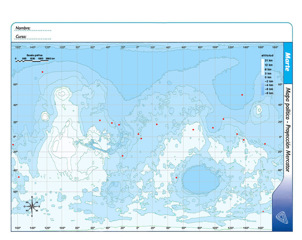
School Map Number 1
Also a A4 size maps as Spanish one.

Argentinean Nº5 size full color school map.
Creating maps of Mars as a way to travel, one can ask if we will be able to know of previously unknown worlds by means of images only?
The known and unknown as the visible and invisible affect each other, they are complementary ones. They are the root of the very mystery of knowing, the mystery of creating a readable description of something we engage in.
Two people took a map at the Baikal Exhibition:
One examined it and asked: Where is the Antarctic?, … Where is Europe? While rotating and trying to decipher it.
The other person took a look at the map and said: “.. mmm”. After a while said: oh! Wait, it’s not the Earth!. IIt’s says Mars! Read there, it says Mars!.
The former one while laughing said: .. What’s this?
When the familiar well known in our memory trick us “for a moment” into recognizing the unexpected.